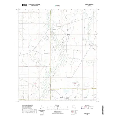
2020 Map of Steep Gully
USGS Topo · Published 2020About this map
The settlement of Elizabeth anchors the southern portion of this 2020 survey, where the borders of Allen, Vernon, and Rapides Parishes converge. This landscape is defined by its extensive network of watercourses, including the central Tenmile Cr and Cherrywinche Cr, which drain the low-lying terrain into named bayous and gullies. Historically significant sites for genealogists are well-marked, such as the Canada Memorial Gardens Elizabeth Cem and the Tenmile Cem located near the small community of Westport. The map reflects a rural infrastructure built around family-named roads like Peg Maricle Rd and Jim Thompson Rd, suggesting long-standing local ties. The presence of Alligator Cr and Cow Bayou illustrates the characteristic wetland drainage patterns of this Louisiana interior, while numerous parish roads like Parish Rd 533 connect isolated homesteads and timber tracts across the parish lines.
Find a feature on this map
57 named features on this map. Tap any name to fly to it.
Don’t see what you’re looking for? This feature index may not catch every label — zoom into the map to look around manually.
Map Details
Editions of this 2020 Steep Gully Map
This is the sole edition of this map. No revisions or reprints were ever made.
Other maps of this area

1935 · Pawnee
USGS Topo · 1:31,680

1935 · Oakdale
USGS Topo · 1:31,680

1942 · Oakdale
USGS Topo · 1:62,500

1943 · Leander
USGS Topo · 1:62,500

1947 · Steep Gully
USGS Topo · 1:31,680

1947 · Elizabeth
USGS Topo · 1:31,680

1947 · Grant
USGS Topo · 1:31,680

1947 · Pitkin
USGS Topo · 1:31,680

1948 · Grant
USGS Topo · 1:24,000

1948 · Elizabeth
USGS Topo · 1:24,000