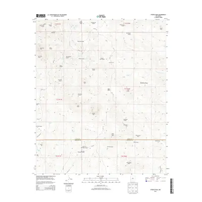
2013 Map of Steeple Rock
USGS Topo · Published 2013About this map
Steeple Rock dominates the high desert landscape of Grant County in this 2013 survey, a prominent landmark in a region defined by complex drainage systems and isolated homesteads. The terrain transitions from the Summit Mountains in the north, including Summit Peak and Vanderbilt Peak, down through a network of rugged canyons such as Pennsylvania Canyon and Silver Bar Canyon. Scattered water sources like White Oak Spring and Kelley Spring, alongside cattle-ranching features like Barney Tank and Freestone Tank, illustrate the essential infrastructure for life in this arid corner of New Mexico.
Find a feature on this map
57 named features on this map. Tap any name to fly to it.
Don’t see what you’re looking for? This feature index may not catch every label — zoom into the map to look around manually.
Map Details
Editions of this 2013 Steeple Rock Map
This is the sole edition of this map. No revisions or reprints were ever made.
Other maps of this area

1954 · Silver City
USGS Topo · 1:250,000

1958 · Silver City
USGS Topo · 1:250,000

1959 · Steeple Rock
USGS Topo · 1:62,500

1959 · Canador Peak
USGS Topo · 1:62,500

1959 · York Valley
USGS Topo · 1:62,500

1960 · Duncan
USGS Topo · 1:62,500

1962 · Silver City
USGS Topo · 1:250,000
1986 · Duncan
USGS Topo · 1:24,000
1986 · Tillie Hall Peak
USGS Topo · 1:24,000
1986 · Goat Camp Spring
USGS Topo · 1:24,000