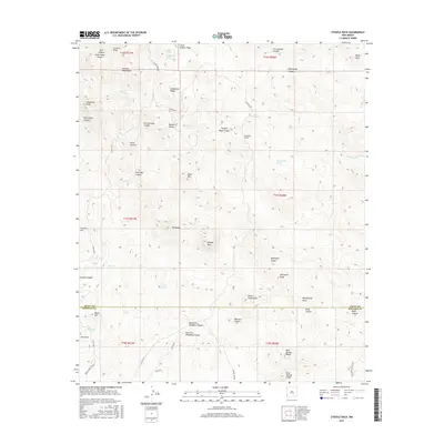
2017 Map of Steeple Rock
USGS Topo · Published 2017About this map
Steeple Rock and the surrounding Summit Mountains dominate this high-desert landscape along the border of Grant and Hidalgo Counties. The area is defined by a complex network of canyons and ridges, including Telephone Ridge and Steeple Rock Canyon, which funnel toward the major drainage of Carlisle Canyon. Remote water sources such as Kelley Spring, Thanksgiving Spring, and Park Spring highlight the essential infrastructure for ranching and survival in this arid environment.
Find a feature on this map
61 named features on this map. Tap any name to fly to it.
Don’t see what you’re looking for? This feature index may not catch every label — zoom into the map to look around manually.
Map Details
Editions of this 2017 Steeple Rock Map
This is the sole edition of this map. No revisions or reprints were ever made.
Other maps of this area

1954 · Silver City
USGS Topo · 1:250,000

1958 · Silver City
USGS Topo · 1:250,000

1959 · Steeple Rock
USGS Topo · 1:62,500

1959 · Canador Peak
USGS Topo · 1:62,500

1959 · York Valley
USGS Topo · 1:62,500

1960 · Duncan
USGS Topo · 1:62,500

1962 · Silver City
USGS Topo · 1:250,000
1986 · Duncan
USGS Topo · 1:24,000
1986 · Tillie Hall Peak
USGS Topo · 1:24,000
1986 · Goat Camp Spring
USGS Topo · 1:24,000