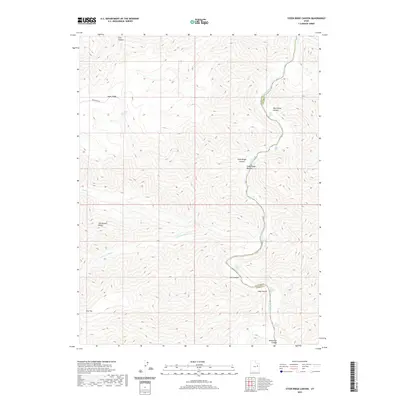
2020 Map of Steer Ridge Canyon
USGS Topo · Published 2020About this map
Green River white water dominates this 2020 landscape as it flows through the deep incisions of Desolation Canyon. This topographical study reveals the complex geography of the Uintah and Carbon county border, where the river's descent is marked by a succession of named whitewater features including Wild Horse Rapids, Steer Ridge Rapids, and Snap Canyon Rapids. The terrain is characterized by high, narrow divides such as Steer Ridge and Van Duesen Ridge that separate deep drainages like Calf Canyon and Wild Horse Canyon. Limited human infrastructure is visible, primarily consisting of the Steer Ridge Rd and the lone Johnson Spring, reflecting a wilderness defined by its hydrologic and geologic barriers. The detailed elevation data captures the transition from high plateaus like Flat Top down to the secluded Steer Ridge Bottom along the riverbank.
Find a feature on this map
24 named features on this map. Tap any name to fly to it.
Don’t see what you’re looking for? This feature index may not catch every label — zoom into the map to look around manually.
Map Details
Editions of this 2020 Steer Ridge Canyon Map
This is the sole edition of this map. No revisions or reprints were ever made.
Other maps of this area

1885 · East Tavaputs
USGS Topo · 1:250,000

1886 · Price River
USGS Topo · 1:250,000

1896 · Price River
USGS Topo · 1:250,000

1953 · Firewater Canyon
USGS Topo · 1:62,500

1954 · Flat Canyon
USGS Topo · 1:62,500

1954 · Range Creek
USGS Topo · 1:62,500

1956 · Price
USGS Topo · 1:250,000

1956 · Grand Junction
USGS Topo · 1:250,000

1959 · Grand Junction
USGS Topo · 1:250,000

1960 · Price
USGS Topo · 1:250,000