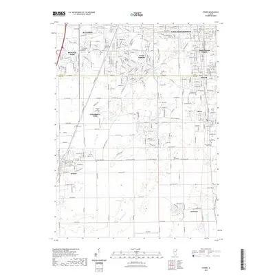
2021 Map of Steger
USGS Topo · Published 2021About this map
Chicago Heights and its neighboring south suburban communities are situated along the boundary between Cook and Will Counties, where a dense network of residential streets meets the open drainage basins of Thorn Creek and Plum Creek. This map reveals a complex religious and genealogical landscape, with numerous local burial grounds including the Bloom Presbyterian Cemetery and the Saint Pauls Evangelical Reform Cemetery. The area is characterized by mid-century suburban development patterns in Park Forest and Richton Park, juxtaposed with major institutional footprints like the campus of Governors State University in University Park. To the south, the terrain opens into agricultural lands near Goodenow, where the Black Walnut Cemetery and Bult Field mark the shift from urban density to rural landscape.
Find a feature on this map
177 named features on this map. Tap any name to fly to it.
Don’t see what you’re looking for? This feature index may not catch every label — zoom into the map to look around manually.
Map Details
Editions of this 2021 Steger Map
This is the sole edition of this map. No revisions or reprints were ever made.
Other maps of this area

1890 · Des Plaines
USGS Topo · 1:62,500

1892 · Calumet
USGS Topo · 1:62,500

1893 · Calumet
USGS Topo · 1:62,500

1894 · Des Plaines
USGS Topo · 1:62,500

1900 · Des Plaines
USGS Topo · 1:62,500

1900 · Calumet
USGS Topo · 1:62,500

1901 · Calumet
USGS Topo · 1:62,500

1901 · Des Plaines
USGS Topo · 1:62,500

1929 · Tinley Park
USGS Topo · 1:24,000

1929 · Calumet City
USGS Topo · 1:24,000