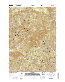
2014 Map of Steins Pillar
USGS Topo · Published 2014About this map
Steins Pillar dominates this 2014 survey of central Oregon, a massive volcanic monolith that has long served as a landmark within the Ochoco National Forest. The landscape is defined by the high elevations of the Ochoco Mountains, where numerous peaks like Wildcat Mtn and Twin Pillars rise above a dense network of drainages. The hydrology of the region is characterized by seasonal and perennial flows including Mill Creek, Fincher Creek, and Hash Rock Creek, many of which are fed by isolated water sources such as King Spring and Born Spring. A modern transportation network of forest service and county routes, including the NE Ochoco Highway and Mill Creek Road, provides access to this remote timber and recreational terrain. The map's detailed topography reveals the complex system of ridges and canyons, such as Squirrel Ridge and Desolation Canyon, that define the geological character of Crook County.
Find a feature on this map
50 named features on this map. Tap any name to fly to it.
Don’t see what you’re looking for? This feature index may not catch every label — zoom into the map to look around manually.
Map Details
Editions of this 2014 Steins Pillar Map
This is the sole edition of this map. No revisions or reprints were ever made.
Other maps of this area

1926 · Mitchell
USGS Topo · 1:125,000

1948 · Ochoco Reservoir
USGS Topo · 1:62,500

1950 · Ochoco Reservoir
USGS Topo · 1:62,500

1951 · Lookout Mtn
USGS Topo · 1:62,500

1955 · Bend
USGS Topo · 1:250,000

1957 · Bend
USGS Topo · 1:250,000

1958 · Bend
USGS Topo · 1:250,000

1968 · Dutchman Creek
USGS Topo · 1:24,000

1968 · Stephenson Mtn
USGS Topo · 1:24,000

1968 · Opal Mountain
USGS Topo · 1:24,000