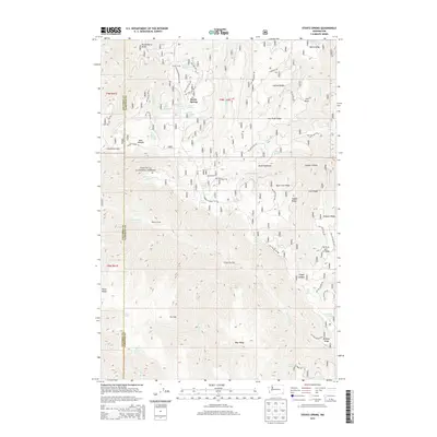
2013 Map of Stentz Spring
USGS Topo · Published 2013About this map
Umatilla National Forest encompasses the southern half of this landscape, where the Tucannon River flows through a series of prominent ridges and drainages. The area is defined by its numerous watering points and seasonal camps, such as Powell Camp and Ruchert Camp, which served as critical nodes for forest management and local activity. The geography is characterized by high, flat-topped features like Elk Flat and several named ridges, including the appropriately named Hard-to-get-to Ridge and Simpson Ridge.
Find a feature on this map
63 named features on this map. Tap any name to fly to it.
Don’t see what you’re looking for? This feature index may not catch every label — zoom into the map to look around manually.
Map Details
Editions of this 2013 Stentz Spring Map
This is the sole edition of this map. No revisions or reprints were ever made.
Other maps of this area

1937 · Pomeroy
USGS Topo · 1:96,000

1942 · Pomeroy
USGS Topo · 1:125,000

1943 · Peola
USGS Topo · 1:62,500

1943 · Saddle Butte
USGS Topo · 1:62,500

1946 · Saddle Butte
USGS Topo · 1:62,500

1946 · Peola
USGS Topo · 1:62,500

1955 · Pullman
USGS Topo · 1:250,000

1958 · Pullman
USGS Topo · 1:250,000

1967 · Rose Springs
USGS Topo · 1:24,000

1967 · Hopkins Ridge
USGS Topo · 1:24,000