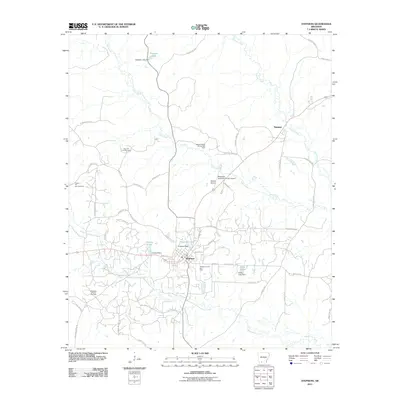
2011 Map of Stephens
USGS Topo · Published 2011About this map
Stephens serves as the central hub for this portion of southern Arkansas, where a landscape defined by resource extraction meets local aviation. The town sits at the intersection of various local routes such as Tidwell St and Hillside St, surrounded by a significant network of energy production sites including the Stephens Oil and Gas Field and the Wesson Oil and Gas Field. The industrial character of the region is further evidenced by the Stephens-Ouachita County Airport and the smaller Wilson Airport to the north.
Find a feature on this map
60 named features on this map. Tap any name to fly to it.
Don’t see what you’re looking for? This feature index may not catch every label — zoom into the map to look around manually.
Map Details
Editions of this 2011 Stephens Map
This is the sole edition of this map. No revisions or reprints were ever made.
Other maps of this area

1901 · Gurdon
USGS Topo · 1:125,000

1903 · Camden
USGS Topo · 1:125,000

1953 · El Dorado
USGS Topo · 1:250,000

1957 · El Dorado
USGS Topo · 1:250,000

1958 · El Dorado
USGS Topo · 1:250,000

1960 · El Dorado
USGS Topo · 1:250,000

1962 · Buena Vista
USGS Topo · 1:24,000

1962 · Mt Holly
USGS Topo · 1:24,000

1964 · Louann
USGS Topo · 1:62,500

1966 · Village
USGS Topo · 1:24,000