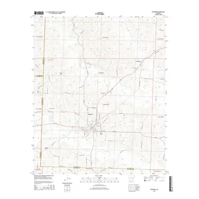
2014 Map of Stephens
USGS Topo · Published 2014About this map
Stephens serves as the primary hub in this southern Arkansas landscape, situated where Us 79 intersects with local routes like Sawmill Rd and Curry Field Rd. The region is defined by its deep roots in the petroleum industry, evidenced by the extensive Stephens Oil and Gas Field and the nearby Wesson Oil and Gas Field. These industrial operations are interspersed with a complex network of waterways, including the winding Smackover Creek and Gum Creek, which drain the low-lying terrain into reservoirs such as Graysons Lake and Brigham Lake. To the northeast, the smaller settlement of Ogemaw sits along the Ouachita 105 Rd, illustrating the dispersed residential patterns typical of this county's history. Local infrastructure is further highlighted by the presence of Wilson Airport, located just north of the central township.
Find a feature on this map
89 named features on this map. Tap any name to fly to it.
Don’t see what you’re looking for? This feature index may not catch every label — zoom into the map to look around manually.
Map Details
Editions of this 2014 Stephens Map
This is the sole edition of this map. No revisions or reprints were ever made.
Other maps of this area

1901 · Gurdon
USGS Topo · 1:125,000

1903 · Camden
USGS Topo · 1:125,000

1953 · El Dorado
USGS Topo · 1:250,000

1957 · El Dorado
USGS Topo · 1:250,000

1958 · El Dorado
USGS Topo · 1:250,000

1960 · El Dorado
USGS Topo · 1:250,000

1962 · Buena Vista
USGS Topo · 1:24,000

1962 · Mt Holly
USGS Topo · 1:24,000

1964 · Louann
USGS Topo · 1:62,500

1966 · Village
USGS Topo · 1:24,000