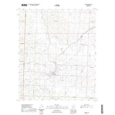
2020 Map of Stephens
USGS Topo · Published 2020About this map
Stephens stands as the primary hub in this southwest Arkansas landscape, where the confluence of several creeks defines the local geography. To the north, the smaller settlement of Ogemaw is positioned near Cypress Cr, while the surrounding terrain is marked by numerous water bodies including Brigham Lake, Graysons Lake, and Hassics Lake. The area's infrastructure is dominated by a dense network of county roads, such as Ouachita Road 8 and Ouachita Road 103, that connect rural homesteads and agricultural tracts across the Ouachita, Nevada, and Columbia county lines. Significant watercourses like Smackover Cr and Little Smackover Cr drain the southern portion of the quadrangle. These drainage patterns, coupled with landmarks like Wilson Airport, illustrate a region defined by its timber and oil heritage, where local transit still follows the contours of the many creek branches and low-lying wetlands.
Find a feature on this map
72 named features on this map. Tap any name to fly to it.
Don’t see what you’re looking for? This feature index may not catch every label — zoom into the map to look around manually.
Map Details
Editions of this 2020 Stephens Map
This is the sole edition of this map. No revisions or reprints were ever made.
Other maps of this area

1901 · Gurdon
USGS Topo · 1:125,000

1903 · Camden
USGS Topo · 1:125,000

1953 · El Dorado
USGS Topo · 1:250,000

1957 · El Dorado
USGS Topo · 1:250,000

1958 · El Dorado
USGS Topo · 1:250,000

1960 · El Dorado
USGS Topo · 1:250,000

1962 · Buena Vista
USGS Topo · 1:24,000

1962 · Mt Holly
USGS Topo · 1:24,000

1964 · Louann
USGS Topo · 1:62,500

1966 · Village
USGS Topo · 1:24,000