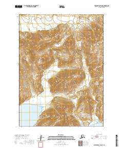
2020 Map of Stepovak Bay D-5 NE
USGS Topo · Published 2020About this map
Ivanof Bay dominates the southwestern corner of this remote Alaskan terrain, where the marine environment meets the foothills of the Aleutian Range. The landscape is defined by its dramatic hydrography, notably the Ivanof River which meanders through the central valley before emptying into the bay, and the smaller Humpback Cr to the southeast. Situated on the Alaska Peninsula, this section of the Stepovak Bay D-5 NE quadrangle shows a region devoid of permanent settlements or roads, focused instead on the raw topography and drainage patterns. The map provides a detailed record of the township and range divisions, such as t49s r66w, which overlay this wilderness area, illustrating how the United States Public Land Survey System accounts for even the most isolated stretches of the territory.
Find a feature on this map
12 named features on this map. Tap any name to fly to it.
Don’t see what you’re looking for? This feature index may not catch every label — zoom into the map to look around manually.
Map Details
Editions of this 2020 Stepovak Bay D-5 NE Map
This is the sole edition of this map. No revisions or reprints were ever made.
Other maps of this area

1951 · Stepovak Bay
USGS Topo · 1:250,000

1963 · Chignik A-4
USGS Topo · 1:63,360

1963 · Stepovak Bay D-4
USGS Topo · 1:63,360

1963 · Chignik A-5
USGS Topo · 1:63,360

1963 · Stepovak Bay D-5
USGS Topo · 1:63,360

1963 · Chignik
USGS Topo · 1:250,000

1963 · Stepovak Bay
USGS Topo · 1:250,000

1969 · Stepovak Bay
USGS Topo · 1:250,000
2020 · Stepovak Bay D-4 NW
USGS Topo · 1:25,000
2020 · Stepovak Bay D-5 SW
USGS Topo · 1:25,000