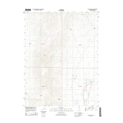
2014 Map of Steptoe Ranch
USGS Topo · Published 2014About this map
Steptoe Ranch sits within a high-desert corridor of White Pine County, where the eastern slopes of the Egan Range descend into the broad Steptoe Valley. This 2014 survey reveals a landscape where survival and settlement are dictated by the presence of water in an otherwise arid basin. A cluster of vital water sources, including Campbell Ranch Springs, Water Canyon Spring, and Grass Springs, suggests the long-standing importance of this specific location for ranching operations. To the west, the topography rises sharply toward the ridgeline, broken by the distinct Molleson Gap and Molleson Canyon. The inclusion of Molleson Spring near these features highlights how early settlers and land managers utilized the natural breaks in the mountain range for movement and resources. The map also delineates the transition between Butte Valley and the surrounding peaks, with seasonal drainage provided by Duck Cr and Combs Cr.
Find a feature on this map
21 named features on this map. Tap any name to fly to it.
Don’t see what you’re looking for? This feature index may not catch every label — zoom into the map to look around manually.
Map Details
Editions of this 2014 Steptoe Ranch Map
This is the sole edition of this map. No revisions or reprints were ever made.
Other maps of this area

1952 · Ely
USGS Topo · 1:125,000

1956 · Ely
USGS Topo · 1:250,000

1958 · McGill
USGS Topo · 1:24,000

1958 · McGill
USGS Topo · 1:62,500

1959 · Ely
USGS Topo · 1:250,000

1959 · Reipetown
USGS Topo · 1:62,500
1962 · Hunter Point
USGS Topo · 1:24,000

1963 · Ely
USGS Topo · 1:250,000

1979 · Mt. Hamilton
USGS Topo · 1:100,000
1982 · Monte Neva Hot Springs
USGS Topo · 1:24,000