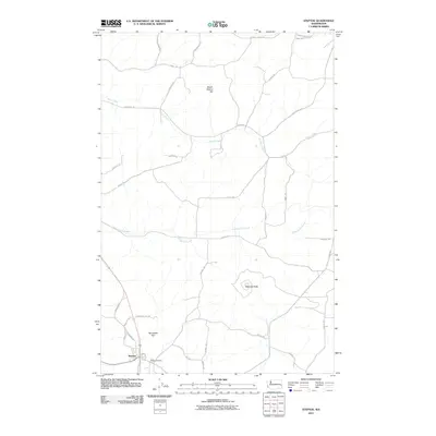
2011 Map of Steptoe
USGS Topo · Published 2011About this map
Steptoe Butte rises as a prominent landmark over the rolling landscape of eastern Washington, marking a transition from the drainage of Thorn Creek in the north to the Cottonwood Creek basin in the south. This 2011 survey illustrates the rural character of Whitman County, centered on the unincorporated community of Steptoe. The settlement is anchored by the Bethel Cemetery and is surrounded by a network of farm-to-market roads named for local families, including F McCroskey Rd and Tuttle-Alexander Rd. Notable topographical features like Steam Shovel Hill and the broad Tennessee Flat reflect the agricultural productivity of the region. The map preserves the specific locations of rural homesteads and transport corridors, such as Oakesdale Rd, providing a clear record of the area's modern land use and its connection to the surrounding Palouse topography.
Find a feature on this map
37 named features on this map. Tap any name to fly to it.
Don’t see what you’re looking for? This feature index may not catch every label — zoom into the map to look around manually.
Map Details
Editions of this 2011 Steptoe Map
This is the sole edition of this map. No revisions or reprints were ever made.
Other maps of this area

1903 · Oakesdale
USGS Topo · 1:125,000

1905 · Oakesdale
USGS Topo · 1:125,000

1910 · Pullman
USGS Topo · 1:125,000

1955 · Pullman
USGS Topo · 1:250,000

1955 · Spokane
USGS Topo · 1:250,000

1958 · Spokane
USGS Topo · 1:250,000

1958 · Pullman
USGS Topo · 1:250,000

1964 · Diamond
USGS Topo · 1:24,000

1964 · Oakesdale
USGS Topo · 1:24,000

1964 · Malden
USGS Topo · 1:24,000