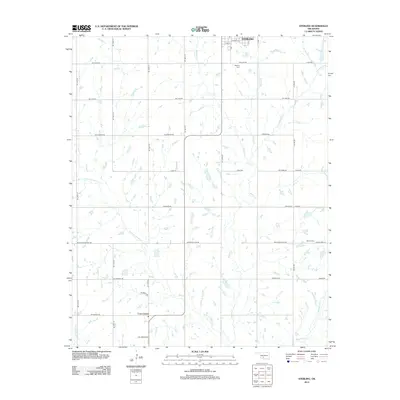
2012 Map of Sterling
USGS Topo · Published 2012About this map
Sterling sits at the northern edge of this southwestern Oklahoma landscape, where the grid of rural section roads meets a complex network of prairie streams. The area is defined by the winding paths of Beaver Creek and its many tributaries, including Ninemile Beaver Creek, Whisky Creek, and Dry Beaver Creek. These waterways create a textured drainage pattern across the agricultural plains, influencing the placement of early infrastructure like Coxs Corner to the south. Local history is anchored by the Sterling Cemetery near the town site and the Denton Cemetery further east toward the Cottonwood Creek drainage. The map reveals a transition from organized town streets like Talbott Street and Park Street to the expansive rural landscape connected by long-established routes such as Northeast Mountain View Road and County Line Road.
Find a feature on this map
40 named features on this map. Tap any name to fly to it.
Don’t see what you’re looking for? This feature index may not catch every label — zoom into the map to look around manually.
Map Details
Editions of this 2012 Sterling Map
This is the sole edition of this map. No revisions or reprints were ever made.
Other maps of this area

1946 · Lawton
USGS Topo · 1:62,500

1949 · Arbuckle Hill
USGS Topo · 1:24,000

1949 · Cement
USGS Topo · 1:62,500

1949 · Elgin
USGS Topo · 1:24,000

1949 · Nellie
USGS Topo · 1:62,500

1955 · Lawton
USGS Topo · 1:250,000

1956 · Sterling
USGS Topo · 1:24,000

1956 · Ninemile Creek
USGS Topo · 1:24,000

1956 · Fletcher
USGS Topo · 1:24,000

1956 · Arbuckle Hill
USGS Topo · 1:24,000