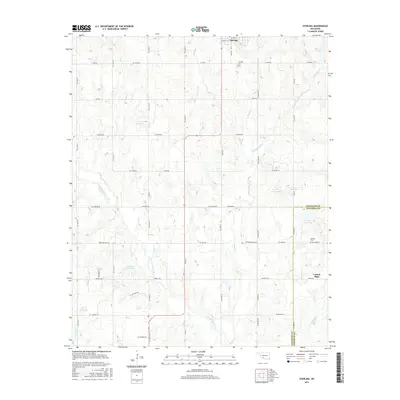
2016 Map of Sterling
USGS Topo · Published 2016About this map
Sterling anchors the northern edge of this landscape where the boundaries of Comanche Co and Stephens Co meet. The area is defined by a dense network of watercourses, most notably the winding paths of Beaver Cr and Ninemile Beaver Cr, which dictate the rural road grid. The terrain is marked by numerous water management features including the 031003 Reservoir and 137086 Reservoir, reflecting the agricultural importance of water catchment in this part of Oklahoma. In the southeast, Central High serves as a local hub near the Denton Cem, while the Sterling Cem sits just outside the main town site to the north. The map preserves a detailed view of the section-line road system, such as Ne 165th ST and Co Line RD, which connect scattered farmsteads across the undulating plains.
Find a feature on this map
55 named features on this map. Tap any name to fly to it.
Don’t see what you’re looking for? This feature index may not catch every label — zoom into the map to look around manually.
Map Details
Editions of this 2016 Sterling Map
This is the sole edition of this map. No revisions or reprints were ever made.
Other maps of this area

1946 · Lawton
USGS Topo · 1:62,500

1949 · Arbuckle Hill
USGS Topo · 1:24,000

1949 · Cement
USGS Topo · 1:62,500

1949 · Elgin
USGS Topo · 1:24,000

1949 · Nellie
USGS Topo · 1:62,500

1955 · Lawton
USGS Topo · 1:250,000

1956 · Sterling
USGS Topo · 1:24,000

1956 · Ninemile Creek
USGS Topo · 1:24,000

1956 · Fletcher
USGS Topo · 1:24,000

1956 · Arbuckle Hill
USGS Topo · 1:24,000