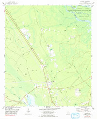
1978 Map of Sterling
USGS Topo · Published 1991About this map
Southern Railway tracks cut a straight diagonal through the heart of the Glynn County lowlands, connecting small rural hubs like Zuta and Hunters Siding. The landscape is dominated by complex hydrologic systems, including the expansive Clayhole Swamp and Buffalo Swamp, which are fed by numerous branches and drains like Cowpen Branch and Oak Head Drain. This 1970s survey documents a network of small, traditional settlements and religious centers such as Pennick, Salem Ch, and Jerusalem Ch that served the local timber or agricultural communities.
Find a feature on this map
62 named features on this map. Tap any name to fly to it.
Don’t see what you’re looking for? This feature index may not catch every label — zoom into the map to look around manually.
Map Details
Editions of this 1978 Sterling Map
2 editions found
Other maps of this area

1918 · Everett City
USGS Topo · 1:62,500

1918 · Bladen
USGS Topo · 1:62,500

1920 · Everett City
USGS Topo · 1:62,500

1921 · Darien
USGS Topo · 1:62,500

1939 · Bladen
USGS Topo · 1:62,500

1944 · Everett City
USGS Topo · 1:62,500

1945 · Brunswick
USGS Topo · 1:62,500

1946 · Brunswick
USGS Topo · 1:250,000

1948 · Brunswick
USGS Topo · 1:250,000
1954 · Ridgeville
USGS Topo · 1:24,000