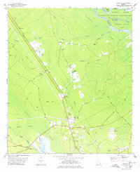
1978 Map of Sterling
USGS Topo · Published 1978About this map
Cowpen Swamp and Honeygall Creek dominate this low-lying coastal Georgia landscape, where the Altamaha River forms the northern boundary at Wrights Island. The region is defined by its transit history, as both the Southern Railway and the Seaboard Coast Line intersect at the community of Sterling. These rail corridors fostered small rail-side settlements and loading points like Hunters Siding and Frazers Crossing.
Find a feature on this map
58 named features on this map. Tap any name to fly to it.
Don’t see what you’re looking for? This feature index may not catch every label — zoom into the map to look around manually.
Map Details
Editions of this 1978 Sterling Map
2 editions found
Other maps of this area

1918 · Everett City
USGS Topo · 1:62,500

1918 · Bladen
USGS Topo · 1:62,500

1920 · Everett City
USGS Topo · 1:62,500

1921 · Darien
USGS Topo · 1:62,500

1939 · Bladen
USGS Topo · 1:62,500

1944 · Everett City
USGS Topo · 1:62,500

1945 · Brunswick
USGS Topo · 1:62,500

1946 · Brunswick
USGS Topo · 1:250,000

1948 · Brunswick
USGS Topo · 1:250,000
1954 · Ridgeville
USGS Topo · 1:24,000