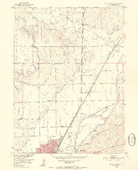
1951 Map of Sterling North
USGS Topo · Published 1952About this map
Sterling serves as the focal point of this 1951 topographic study, characterized by a complex network of irrigation that supports the agriculture of the South Platte River valley. A dense system of waterways, including the Sterling No 1 Ditch, Sterling No 2 Ditch, and Lowline Ditch, crisscrosses the landscape, reflecting the intensive water management necessary for High Plains farming. The expansion of the town is evident through the presence of Sterling Junior College and the Fair Grounds, while the rural surroundings are anchored by a series of valley schools such as Springdale Valley School and Minto Valley School.
Find a feature on this map
36 named features on this map. Tap any name to fly to it.
Don’t see what you’re looking for? This feature index may not catch every label — zoom into the map to look around manually.
Map Details
Editions of this 1951 Sterling North Map
4 editions found
Other maps of this area

1951 · Reiradon Hill
USGS Topo · 1:24,000

1951 · Sterling South
USGS Topo · 1:24,000

1951 · Sterling North
USGS Topo · 1:24,000

1951 · Galien
USGS Topo · 1:24,000

1951 · Atwood NE
USGS Topo · 1:24,000

1951 · Iliff
USGS Topo · 1:24,000

1951 · Atwood
USGS Topo · 1:24,000

1952 · Padroni
USGS Topo · 1:24,000

1954 · Sterling
USGS Topo · 1:250,000

1958 · Sterling
USGS Topo · 1:250,000