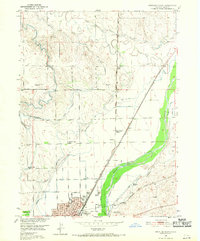
1951 Map of Sterling North
USGS Topo · Published 1971About this map
The South Platte River valley defines the agricultural and industrial character of this region, where a complex network of irrigation systems like the North Sterling Canal and Sterling No 1 Ditch supports the high plains landscape. North of the city of Sterling, the terrain transitions from the river's fertile bottomlands to a series of bluffs and drainages, including the North Branch Cedar Creek.
Find a feature on this map
32 named features on this map. Tap any name to fly to it.
Don’t see what you’re looking for? This feature index may not catch every label — zoom into the map to look around manually.
Map Details
Editions of this 1951 Sterling North Map
4 editions found
Other maps of this area

1951 · Reiradon Hill
USGS Topo · 1:24,000

1951 · Sterling South
USGS Topo · 1:24,000

1951 · Sterling North
USGS Topo · 1:24,000

1951 · Galien
USGS Topo · 1:24,000

1951 · Atwood NE
USGS Topo · 1:24,000

1951 · Iliff
USGS Topo · 1:24,000

1951 · Atwood
USGS Topo · 1:24,000

1952 · Padroni
USGS Topo · 1:24,000

1954 · Sterling
USGS Topo · 1:250,000

1958 · Sterling
USGS Topo · 1:250,000