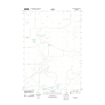
2011 Map of Sterling SW
USGS Topo · Published 2011About this map
Molasses River and its various managed waters dominate this central Michigan landscape, characterized by the expansive Molasses River Flooding Number One, Molasses River Flooding Number Two, and Molasses River Flooding Number Five. These flooded areas, alongside Wells Creek, suggest a terrain shaped by water management and conservation efforts in Grim Township. The human imprint on the land is defined by a network of utility and forestry routes, such as Lame Duck Truck Trl and Sterling Truck Trl, which connect small points of interest like Bowmanville and the uniquely named Hard Luck. The presence of roads like Second Dam Rd and the East Center Fire Lane Trl highlights the area's history as a managed wilderness, where access was primarily developed for fire control and resource management.
Find a feature on this map
19 named features on this map. Tap any name to fly to it.
Don’t see what you’re looking for? This feature index may not catch every label — zoom into the map to look around manually.
Map Details
Editions of this 2011 Sterling SW Map
This is the sole edition of this map. No revisions or reprints were ever made.
Other maps of this area

1954 · Traverse City
USGS Topo · 1:250,000

1954 · Midland
USGS Topo · 1:250,000

1958 · Traverse City
USGS Topo · 1:250,000

1958 · Midland
USGS Topo · 1:250,000

1959 · Midland
USGS Topo · 1:250,000

1966 · Midland
USGS Topo · 1:250,000
1967 · Mount Forest
USGS Topo · 1:24,000

1968 · Sterling
USGS Topo · 1:24,000
1968 · Skidway Lake
USGS Topo · 1:24,000

1968 · Sterling SW
USGS Topo · 1:24,000