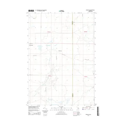
2014 Map of Sterling SW
USGS Topo · Published 2014About this map
Molasses River dominates this portion of the Gladwin and Arenac county line, winding through a series of managed wetland areas including Molasses River Flooding Number One, Molasses River Flooding Number Two, and Molasses River Flooding Number Five. These flooded basins suggest a landscape heavily influenced by water management and conservation efforts in the early 21st century. The small settlements of Bowmanville and the aptly named Hard Luck sit within a grid of remote roads and trails, such as the Sterling Truck Trl and Center Fireline Trl, which navigate the low-lying terrain. To the northeast, the waters of Wells Cr cross the township lines, while the southern boundary is marked by the approach to Secord Dam Rd. The map illustrates a quiet, rural interior where the hydrology of the river system dictates the placement of transit routes and small outposts.
Find a feature on this map
23 named features on this map. Tap any name to fly to it.
Don’t see what you’re looking for? This feature index may not catch every label — zoom into the map to look around manually.
Map Details
Editions of this 2014 Sterling SW Map
This is the sole edition of this map. No revisions or reprints were ever made.
Other maps of this area

1954 · Traverse City
USGS Topo · 1:250,000

1954 · Midland
USGS Topo · 1:250,000

1958 · Traverse City
USGS Topo · 1:250,000

1958 · Midland
USGS Topo · 1:250,000

1959 · Midland
USGS Topo · 1:250,000

1966 · Midland
USGS Topo · 1:250,000
1967 · Mount Forest
USGS Topo · 1:24,000

1968 · Sterling
USGS Topo · 1:24,000
1968 · Skidway Lake
USGS Topo · 1:24,000

1968 · Sterling SW
USGS Topo · 1:24,000