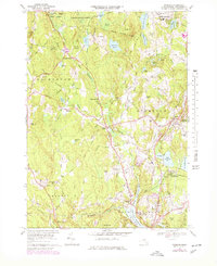
1968 Map of Sterling
USGS Topo · Published 1979About this map
The Stillwater River and Quinapoxet River define the landscape of this central Massachusetts region, converging near the Wachusett Reservoir Thomas Basin. The map illustrates a transitional period of infrastructure, showing the extensive Aqueduct system and multiple utility shafts, such as Shaft No 1, which supported regional water management. In the north, the Leominster State Forest covers the terrain around Justice Hill, while the village of Sterling serves as a central hub for the surrounding countryside. Genealogical data is particularly dense, with several family-named landmarks and historical burial grounds including Legge Cem and High Plain Cem. The Boston and Maine Railroad corridors provide evidence of the era's transport network, connecting local points like Sterling Junction and Oakdale to the broader New England rail system.
Find a feature on this map
86 named features on this map. Tap any name to fly to it.
Don’t see what you’re looking for? This feature index may not catch every label — zoom into the map to look around manually.
Map Details
Editions of this 1968 Sterling Map
3 editions found
Other maps of this area

1885 · Worcester
USGS Topo · 1:62,500

1886 · Worcester
USGS Topo · 1:62,500

1887 · Marlboro
USGS Topo · 1:62,500

1887 · Fitchburg
USGS Topo · 1:62,500

1889 · Marlboro
USGS Topo · 1:62,500

1889 · Fitchburg
USGS Topo · 1:62,500

1892 · Worcester
USGS Topo · 1:62,500

1893 · Fitchburg
USGS Topo · 1:62,500

1893 · Groton
USGS Topo · 1:62,500

1896 · Marlboro
USGS Topo · 1:62,500