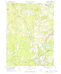
1968 Map of Sterling
USGS Topo · Published 1977About this map
The Stillwater River and Quinapoxet River converge in the south, feeding into the Wachusett Reservoir and Stillwater Basin. This 1960s landscape shows the critical water infrastructure of central Massachusetts, including the subsurface route of the Quabbin Aqueduct and several numbered shafts. In the hills above the reservoir, settlements like West Sterling and East Princeton maintain their traditional character near the expansive Leominster State Forest.
Find a feature on this map
135 named features on this map. Tap any name to fly to it.
Don’t see what you’re looking for? This feature index may not catch every label — zoom into the map to look around manually.
Map Details
Editions of this 1968 Sterling Map
3 editions found
Other maps of this area

1885 · Worcester
USGS Topo · 1:62,500

1886 · Worcester
USGS Topo · 1:62,500

1887 · Marlboro
USGS Topo · 1:62,500

1887 · Fitchburg
USGS Topo · 1:62,500

1889 · Marlboro
USGS Topo · 1:62,500

1889 · Fitchburg
USGS Topo · 1:62,500

1892 · Worcester
USGS Topo · 1:62,500

1893 · Fitchburg
USGS Topo · 1:62,500

1893 · Groton
USGS Topo · 1:62,500

1896 · Marlboro
USGS Topo · 1:62,500