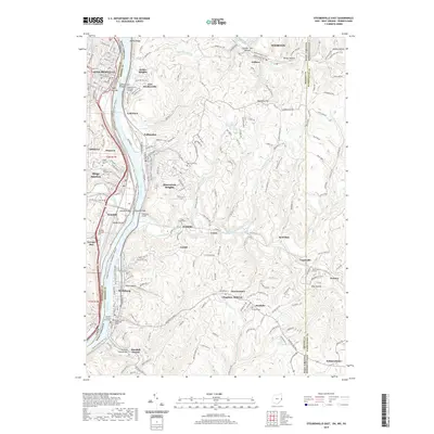
2019 Map of Steubenville East
USGS Topo · Published 2019About this map
The Ohio River serves as the central artery for this industrial corridor, dividing the settlements of Steubenville and Mingo Junction from their West Virginia neighbors. The landscape is characterized by steep valley walls and narrow hollows like Skull Hollow and Number Two Hollow, where residential pockets such as Coketown and Follansbee cling to the riverfront benches. These communities are physically connected by landmark crossings including the Market Street Bridge and the Wabash Bridge, reflecting the region's long-standing reliance on heavy transport.
Find a feature on this map
76 named features on this map. Tap any name to fly to it.
Don’t see what you’re looking for? This feature index may not catch every label — zoom into the map to look around manually.
Map Details
Editions of this 2019 Steubenville East Map
This is the sole edition of this map. No revisions or reprints were ever made.
Other maps of this area

1902 · Wheeling
USGS Topo · 1:62,500

1904 · Steubenville
USGS Topo · 1:62,500

1904 · Burgettstown
USGS Topo · 1:62,500

1906 · Burgettstown
USGS Topo · 1:62,500

1907 · Claysville
USGS Topo · 1:62,500

1935 · Wheeling
USGS Topo · 1:62,500

1935 · Steubenville
USGS Topo · 1:62,500

1942 · Wheeling
USGS Topo · 1:62,500

1942 · Steubenville
USGS Topo · 1:62,500

1951 · Canton
USGS Topo · 1:250,000