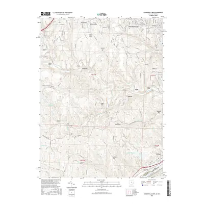
2016 Map of Steubenville West
USGS Topo · Published 2016About this map
Steubenville and its westward expansion into Wintersville define the northern portion of this landscape, where the plateau gives way to the deep, winding valley of Cross Creek. The 2016 terrain is marked by significant industrial and transportation engineering, including a series of rail passages such as the Oliver Tunnel, Hunter Tunnel, Gould Tunnel, and Adams Tunnel. These features trace the historical rail corridors that navigated the region's sharp ridges and hollows, connecting settlements like Gould, Kolmont, and New Alexandria. In the southeast, the Ohio River frontage at Brilliant and the large Cardinal Fly Ash Retention Reservoir reflect the heavy industrial presence that has long anchored the local economy. Genealogists will find numerous burial sites across the township lines, from the large Union Cem and Mount Calvary Cem in the city to rural landmarks like the Tent Church Cem and Cross Creek Presbyterian Cem.
Find a feature on this map
222 named features on this map. Tap any name to fly to it.
Don’t see what you’re looking for? This feature index may not catch every label — zoom into the map to look around manually.
Map Details
Editions of this 2016 Steubenville West Map
This is the sole edition of this map. No revisions or reprints were ever made.
Other maps of this area

1901 · Cadiz
USGS Topo · 1:62,500

1902 · Wheeling
USGS Topo · 1:62,500

1903 · Cadiz
USGS Topo · 1:62,500

1904 · Steubenville
USGS Topo · 1:62,500

1905 · St. Clairsville
USGS Topo · 1:62,500

1935 · Wheeling
USGS Topo · 1:62,500

1935 · Steubenville
USGS Topo · 1:62,500

1942 · Wheeling
USGS Topo · 1:62,500

1942 · Steubenville
USGS Topo · 1:62,500

1951 · Canton
USGS Topo · 1:250,000