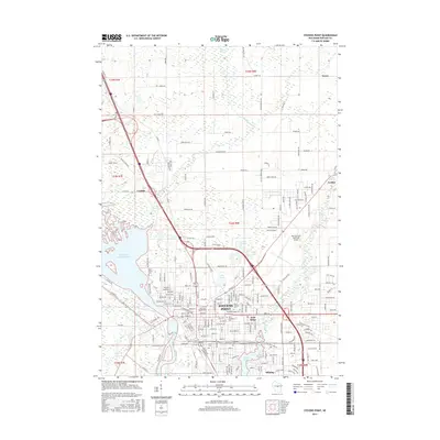
2015 Map of Stevens Point
USGS Topo · Published 2015About this map
Stevens Point serves as the central hub of this Portage County landscape, where the Wisconsin River and Plover River define the local geography. The map captures the urban layout of the city alongside its neighboring villages of Park Ridge and Whiting. Educational and industrial foundations are prominent, notably the Univ of Wisconsin-Stevens Point campus and the infrastructure of the Soo Line RR.
Find a feature on this map
197 named features on this map. Tap any name to fly to it.
Don’t see what you’re looking for? This feature index may not catch every label — zoom into the map to look around manually.
Map Details
Editions of this 2015 Stevens Point Map
This is the sole edition of this map. No revisions or reprints were ever made.
Other maps of this area

1955 · Rosholt
USGS Topo · 1:48,000

1955 · Green Bay
USGS Topo · 1:250,000

1956 · Stevens Point
USGS Topo · 1:48,000

1957 · Amherst
USGS Topo · 1:48,000

1957 · Whiting
USGS Topo · 1:48,000

1969 · Arnott
USGS Topo · 1:24,000

1969 · Rosholt NW
USGS Topo · 1:24,000
1969 · Polonia
USGS Topo · 1:24,000

1970 · Stevens Point
USGS Topo · 1:24,000
1970 · Rocky Run
USGS Topo · 1:24,000