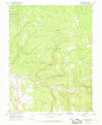
1966 Map of Steves Mtn
USGS Topo · Published 1968About this map
Fishlake National Forest encompasses the vast majority of this mid-1960s survey, illustrating a landscape defined by dramatic elevation changes and a network of named canyons and ridges. The drainage of Salina Creek cuts through the southern portion of the quadrangle, serving as a primary corridor for movement between the high plateaus. Evidence of resource extraction is clear along the slopes above the creek, where mines, a Prospect, and a specific coal-related site at Coal Hollow are documented, highlighting the region's industrial ties to mining.
Find a feature on this map
60 named features on this map. Tap any name to fly to it.
Don’t see what you’re looking for? This feature index may not catch every label — zoom into the map to look around manually.
Map Details
Editions of this 1966 Steves Mtn Map
This is the sole edition of this map. No revisions or reprints were ever made.
Other maps of this area

1885 · Manti
USGS Topo · 1:250,000

1885 · Fish Lake
USGS Topo · 1:250,000

1895 · Manti
USGS Topo · 1:250,000

1896 · Fish Lake
USGS Topo · 1:250,000

1956 · Salina
USGS Topo · 1:250,000

1956 · Price
USGS Topo · 1:250,000

1960 · Price
USGS Topo · 1:250,000

1960 · Salina
USGS Topo · 1:250,000

1962 · Salina
USGS Topo · 1:250,000

1962 · Price
USGS Topo · 1:250,000