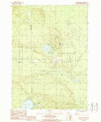
1987 Map of Stewart Lake
USGS Topo · Published 1988About this map
The Manistee National Forest and Pere Marquette State Forest dominate this Lake County landscape, meeting along a surveyed boundary that divides the townships of Eden and Peacock. The region is defined by a dense network of glacial lakes and wetlands, including Wolf Lake in the south and the smaller Ingerman Lake and Stewart Lake to the north. These water bodies are connected by a system of drainage including the Manistee River, Syers Creek, and Twin Creek, which cut through the forested terrain.
Find a feature on this map
24 named features on this map. Tap any name to fly to it.
Don’t see what you’re looking for? This feature index may not catch every label — zoom into the map to look around manually.
Map Details
Editions of this 1987 Stewart Lake Map
This is the sole edition of this map. No revisions or reprints were ever made.
Other maps of this area

1931 · Baldwin NW
USGS Topo · 1:31,680

1931 · Baldwin NE
USGS Topo · 1:31,680

1932 · Chase NW
USGS Topo · 1:31,680

1933 · Peacock SE
USGS Topo · 1:31,680

1933 · Peacock SW
USGS Topo · 1:31,680

1933 · Peacock NE
USGS Topo · 1:31,680

1933 · Luther SW
USGS Topo · 1:31,680

1933 · Luther NW
USGS Topo · 1:31,680

1933 · Peacock NW
USGS Topo · 1:31,680

1954 · Traverse City
USGS Topo · 1:250,000