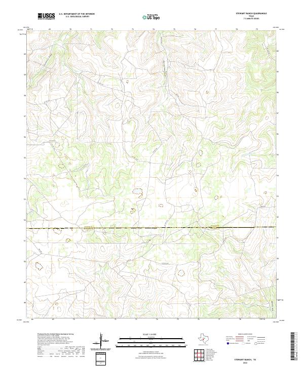
2022 Map of Stewart Ranch
USGS Topo · Published 2022About this map
Dry Llano River carves through this high-plateau landscape on the Edwards Plateau, where seasonal drainage patterns define the geography. The map illustrates a network of ephemeral watercourses including Tenmile Draw, Rattlesnake Draw, and McKenzie Draw, which highlight the arid hydrological character of the region. This 2022 survey documents the boundary between Sutton and Edwards Counties, showing a land use dominated by ranching and private landholdings. A system of private access roads like Ross Rd and Station B Rd navigate the undulating contours, providing essential transit routes between remote homesteads and local infrastructure in this sparsely populated portion of the Texas Hill Country.
Find a feature on this map
16 named features on this map. Tap any name to fly to it.
Don’t see what you’re looking for? This feature index may not catch every label — zoom into the map to look around manually.
Map Details
Editions of this 2022 Stewart Ranch Map
This is the sole edition of this map. No revisions or reprints were ever made.
Other maps of this area

1893 · Rock Springs
USGS Topo · 1:125,000

1954 · Sonora
USGS Topo · 1:250,000

1958 · Sonora
USGS Topo · 1:250,000

1962 · Stewart Ranch
USGS Topo · 1:24,000
1962 · Bundy Ranch
USGS Topo · 1:24,000

1963 · Steen Lake
USGS Topo · 1:24,000

1963 · Harrison Ranch
USGS Topo · 1:24,000

1963 · Live Oak Draw
USGS Topo · 1:24,000
1963 · Fort Terrett Ranch
USGS Topo · 1:24,000

1970 · Ray Lake NW
USGS Topo · 1:24,000