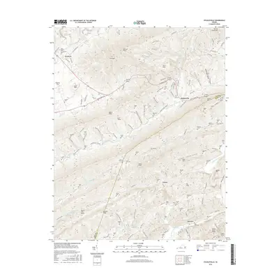
2016 Map of Stickleyville
USGS Topo · Published 2016About this map
Stickleyville and its surrounding mountain gaps serve as a crossroads where the historic Wilderness Rd and Daniel Boone Trl converge. This 2016 survey highlights the intricate topography of Lee and Scott Counties, defined by parallel ridgelines like Wallen Ridge and Powell Mtn. The valley floors are dotted with numerous small family burial sites, such as the Graham Cem, Fannin Cem, and Gilliam Cem, offering a detailed spatial record for genealogical research in this Appalachian corner. The landscape is carved by the N Fork Clinch River and Northeast Fork Blackwater Cr, creating distinct hollows like Rasnic Hollow and Kimberland Hollow. To the south, the village of Fairview sits near England Valley, while distinctive geological features like The Sinks and Potato Hill Knobs punctuate the limestone-heavy terrain of the Sulphur Spring Valley.
Find a feature on this map
79 named features on this map. Tap any name to fly to it.
Don’t see what you’re looking for? This feature index may not catch every label — zoom into the map to look around manually.
Map Details
Editions of this 2016 Stickleyville Map
This is the sole edition of this map. No revisions or reprints were ever made.
Other maps of this area

1887 · Jonesville
USGS Topo · 1:125,000

1891 · Jonesville
USGS Topo · 1:125,000

1894 · Estillville
USGS Topo · 1:125,000

1916 · Nolansburg
USGS Topo · 1:48,000

1919 · Nolansburg
USGS Topo · 1:62,500

1921 · Big Stone Gap
USGS Topo · 1:48,000

1922 · Big Stone Gap
USGS Topo · 1:62,500

1929 · Big Stone Gap
USGS Topo · 1:62,500

1935 · Kyles Ford
USGS Topo · 1:24,000

1935 · Looneys Gap
USGS Topo · 1:24,000