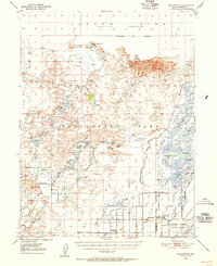
1950 Map of Stillwater
USGS Topo · Published 1955About this map
Carson Sink and its surrounding alkali flats dominate the northern expanse of this 1950s terrain study, revealing a complex hydrological landscape managed for both agriculture and conservation. The Fallon Indian Reservation occupies the southwestern portion, featuring the Fallon Indian Sub-Agency, a local Cem, and a network of irrigation works like the Stillwater Irrigation Canal.
Find a feature on this map
44 named features on this map. Tap any name to fly to it.
Don’t see what you’re looking for? This feature index may not catch every label — zoom into the map to look around manually.
Map Details
Editions of this 1950 Stillwater Map
4 editions found
Other maps of this area

1908 · Carson Sink
USGS Topo · 1:250,000

1910 · Carson Sink
USGS Topo · 1:250,000

1950 · Stillwater
USGS Topo · 1:62,500

1951 · Carson Lake
USGS Topo · 1:62,500

1951 · Soda Lake
USGS Topo · 1:62,500

1951 · Carson Sink
USGS Topo · 1:62,500

1951 · Desert Peak
USGS Topo · 1:62,500

1951 · Fallon
USGS Topo · 1:62,500

1957 · Reno
USGS Topo · 1:250,000

1959 · Reno
USGS Topo · 1:250,000