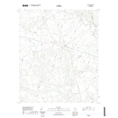
2020 Map of Stilson
USGS Topo · Published 2020About this map
The settlement of Stilson serves as a central hub in this coastal plain landscape, where the agricultural grid of Bulloch County meets the winding course of the Ogeechee River. The terrain is defined by an intricate network of wetlands and seasonal drainages, including Upper Black Cr, Iric Br, and Pole Br, which converge toward Cooks Island in the south. This environment dictated the placement of early homesteads and community centers, visible in the distribution of family-named landmarks and rural burial grounds such as McElveen Cem and Friendship Cem. A notable geographic feature is the Railroad Bed RD, tracing a former transit corridor that once linked Arcola and Stilson to larger markets. This infrastructure, combined with the presence of Lester Pond and Kendrick Pond, illustrates how local industry and settlement patterns were closely tied to the region's hydrology and timber history.
Find a feature on this map
78 named features on this map. Tap any name to fly to it.
Don’t see what you’re looking for? This feature index may not catch every label — zoom into the map to look around manually.
Map Details
Editions of this 2020 Stilson Map
This is the sole edition of this map. No revisions or reprints were ever made.
Other maps of this area

1919 · Egypt
USGS Topo · 1:62,500

1920 · Pembroke
USGS Topo · 1:62,500

1920 · Meldrim
USGS Topo · 1:62,500

1921 · Brooklet
USGS Topo · 1:62,500

1939 · Egypt
USGS Topo · 1:62,500

1942 · Meldrim
USGS Topo · 1:62,500

1943 · Brooklet
USGS Topo · 1:62,500

1943 · Egypt
USGS Topo · 1:62,500

1947 · Savannah
USGS Topo · 1:250,000

1948 · Savannah
USGS Topo · 1:250,000