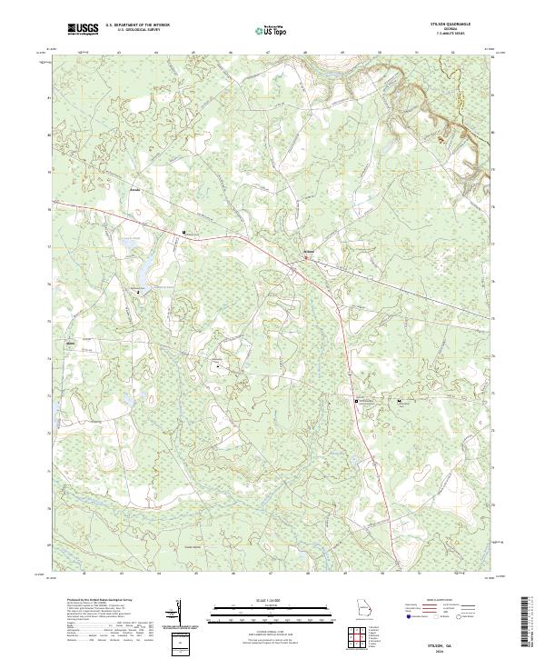
2024 Map of Stilson
USGS Topo · Published 2024About this map
The community of Stilson serves as a central hub in this section of Bulloch County, where the modern landscape is defined by its agricultural roots and proximity to the Ogeechee River. Significant for genealogical research, the area is dotted with several burial sites including Old Fellowship Missionary Cem, Fellowship Cem, and Friendship Cem. The presence of Railroad Bed Rd suggests the historical path of former rail lines that once connected these rural settlements like Arcola and Akins. The topography is characterized by low-lying wetlands and drainage basins, most notably Brannen Bay and the winding course of Upper Black Creek. Near the river, landmarks such as Old Beasley Lndg point to the area's history of river-based commerce and travel. The map captures a transition where the eastern boundary meets the Bulloch and Effingham county line.
Find a feature on this map
76 named features on this map. Tap any name to fly to it.
Don’t see what you’re looking for? This feature index may not catch every label — zoom into the map to look around manually.
Map Details
Editions of this 2024 Stilson Map
This is the sole edition of this map. No revisions or reprints were ever made.
Other maps of this area

1919 · Egypt
USGS Topo · 1:62,500

1920 · Pembroke
USGS Topo · 1:62,500

1920 · Meldrim
USGS Topo · 1:62,500

1921 · Brooklet
USGS Topo · 1:62,500

1939 · Egypt
USGS Topo · 1:62,500

1942 · Meldrim
USGS Topo · 1:62,500

1943 · Brooklet
USGS Topo · 1:62,500

1943 · Egypt
USGS Topo · 1:62,500

1947 · Savannah
USGS Topo · 1:250,000

1948 · Savannah
USGS Topo · 1:250,000