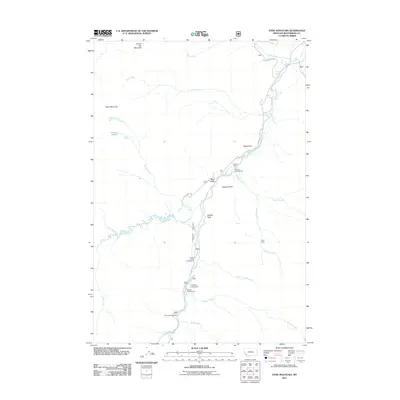
2011 Map of Stine Mountain
USGS Topo · Published 2011About this map
Stine Mountain and Round Top Mountain anchor this high-elevation landscape in Beaverhead County, where the Wise River serves as the primary drainage corridor. The settlement pattern is defined largely by seasonal and recreational use, indicated by a series of established sites along the river including Fourth of July Campground, Lodgepole Campground, and Willow Campground. Historical industrial activity is evidenced by the Atlas Mine, located on a slope above Clifford Creek.
Find a feature on this map
29 named features on this map. Tap any name to fly to it.
Don’t see what you’re looking for? This feature index may not catch every label — zoom into the map to look around manually.
Map Details
Editions of this 2011 Stine Mountain Map
This is the sole edition of this map. No revisions or reprints were ever made.
Other maps of this area

1893 · Dillon
USGS Topo · 1:250,000

1955 · Dillon
USGS Topo · 1:250,000

1957 · Dillon
USGS Topo · 1:250,000

1958 · Dillon
USGS Topo · 1:250,000

1958 · Vipond Park
USGS Topo · 1:62,500

1961 · Wise River
USGS Topo · 1:24,000

1962 · Dillon
USGS Topo · 1:250,000
1962 · Dickie Hills
USGS Topo · 1:24,000
1962 · Foolhen Mountain
USGS Topo · 1:24,000

1965 · Dillon
USGS Topo · 1:250,000