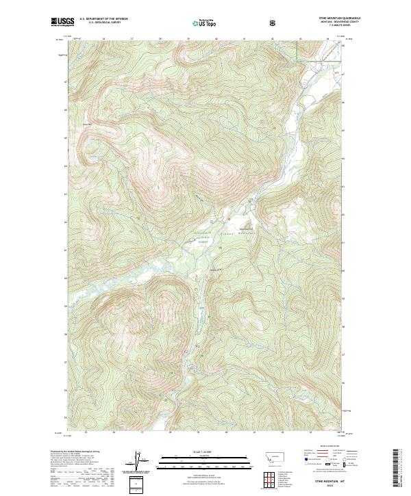
2024 Map of Stine Mountain
USGS Topo · Published 2024About this map
Beaverhead National Forest encompasses the high-elevation terrain of the Pioneer Mountains, where the headwaters of the Wise River carve a complex drainage network. This modern survey illustrates the rugged topography surrounding Stine Mtn, a prominent peak that anchors the western edge of the quadrangle. The map details the hydrological transition from alpine Grouse Lakes to the lower valley floors, tracing the course of Grouse Creek and Evans Creek as they descend toward the main river channel.
Find a feature on this map
28 named features on this map. Tap any name to fly to it.
Don’t see what you’re looking for? This feature index may not catch every label — zoom into the map to look around manually.
Map Details
Editions of this 2024 Stine Mountain Map
This is the sole edition of this map. No revisions or reprints were ever made.
Other maps of this area

1893 · Dillon
USGS Topo · 1:250,000

1955 · Dillon
USGS Topo · 1:250,000

1957 · Dillon
USGS Topo · 1:250,000

1958 · Dillon
USGS Topo · 1:250,000

1958 · Vipond Park
USGS Topo · 1:62,500

1961 · Wise River
USGS Topo · 1:24,000

1962 · Dillon
USGS Topo · 1:250,000
1962 · Dickie Hills
USGS Topo · 1:24,000
1962 · Foolhen Mountain
USGS Topo · 1:24,000

1965 · Dillon
USGS Topo · 1:250,000