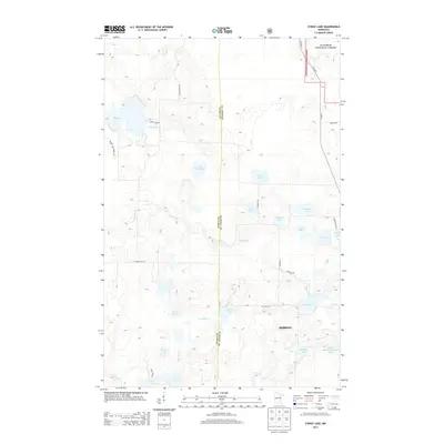
2013 Map of Stingy Lake
USGS Topo · Published 2013About this map
Stingy Lake and the headwaters of the Prairie River define this Iron Range landscape along the border of Itasca and Saint Louis counties. The 2013 topography reveals a region deeply tied to its glacial and industrial heritage, dominated by numerous water bodies like Lake Twentyfour, Gansey Lake, and Day Lake. A significant portion of the northeastern corner is occupied by the Superior National Forest, while the southeastern quadrant reflects the area's mining footprint with the massive Hibbing Taconite Tailings Basin. This basin serves as a stark contrast to the surrounding natural drainage patterns of Day Brook and the East River. Smaller named lakes such as Kleffman Lake and Loven Lake are scattered throughout, connected by a network of forest roads like Stingy Lake Trl and Powers Rd that facilitate access through the dense woodland and wetland terrain.
Find a feature on this map
34 named features on this map. Tap any name to fly to it.
Don’t see what you’re looking for? This feature index may not catch every label — zoom into the map to look around manually.
Map Details
Editions of this 2013 Stingy Lake Map
This is the sole edition of this map. No revisions or reprints were ever made.
Other maps of this area

1951 · Hibbing
USGS Topo · 1:24,000

1952 · Keewatin
USGS Topo · 1:24,000

1952 · Nashwauk
USGS Topo · 1:24,000

1954 · Hibbing
USGS Topo · 1:250,000

1955 · Dewey Lake NW
USGS Topo · 1:24,000

1955 · Dewey Lake
USGS Topo · 1:24,000

1957 · Hibbing
USGS Topo · 1:250,000

1957 · Hibbing
USGS Topo · 1:24,000

1958 · Hibbing
USGS Topo · 1:250,000

1964 · Hibbing
USGS Topo · 1:250,000