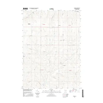
2016 Map of Stitzer
USGS Topo · Published 2016About this map
Stitzer and Annaton anchor this portion of Grant County, where the driftless landscape is defined by deep drainages like Shaw Hollow and Cass Hollow. The map reveals a rural infrastructure built around small crossroads and family landholdings, connected by a network of descriptive routes such as Military Rd and Mill Dam Rd. Local history is embedded in the road names, with Blue School Rd and Rock School Rd marking the locations of former educational centers.
Find a feature on this map
56 named features on this map. Tap any name to fly to it.
Don’t see what you’re looking for? This feature index may not catch every label — zoom into the map to look around manually.
Map Details
Editions of this 2016 Stitzer Map
This is the sole edition of this map. No revisions or reprints were ever made.
Other maps of this area

1900 · Lancaster
USGS Topo · 1:125,000

1902 · Mineral Point
USGS Topo · 1:125,000

1904 · Lancaster
USGS Topo · 1:125,000

1905 · Richland Center
USGS Topo · 1:125,000

1908 · Lancaster
USGS Topo · 1:125,000

1933 · Boscobel
USGS Topo · 1:62,500

1952 · Rewey
USGS Topo · 1:24,000

1952 · Montfort
USGS Topo · 1:24,000

1958 · La Crosse
USGS Topo · 1:250,000

1959 · Dubuque
USGS Topo · 1:250,000