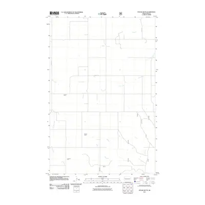
2011 Map of Stocke Butte
USGS Topo · Published 2011About this map
Stocke Butte rises as a prominent landmark in this segment of McKenzie County, anchoring a landscape defined by ranching operations and seasonal waterways. The map documents rural land use at the start of the decade, centering on the A Gravos Ranch to the north and the L Anderson Ranch further south. These family-named holdings highlight the ranching heritage of the region, where wide-reaching section lines and access roads like County Rd 27 and County Rd 30 structure the plains. The drainage patterns of the area are traced through the winding paths of Cherry Creek and Red Wing Creek, which provide vital water sources for the cattle operations that have historically shaped this part of North Dakota.
Find a feature on this map
13 named features on this map. Tap any name to fly to it.
Don’t see what you’re looking for? This feature index may not catch every label — zoom into the map to look around manually.
Map Details
Editions of this 2011 Stocke Butte Map
This is the sole edition of this map. No revisions or reprints were ever made.
Other maps of this area

1953 · Watford City
USGS Topo · 1:250,000

1957 · Watford City
USGS Topo · 1:250,000

1958 · Long X Divide
USGS Topo · 1:24,000

1958 · Sperati Point
USGS Topo · 1:24,000

1958 · Stocke Butte
USGS Topo · 1:24,000

1958 · Tepee Buttes
USGS Topo · 1:24,000

1967 · Watford City
USGS Topo · 1:250,000

1972 · Bear Butte
USGS Topo · 1:24,000

1972 · Rawson
USGS Topo · 1:24,000

1978 · Arnegard
USGS Topo · 1:24,000