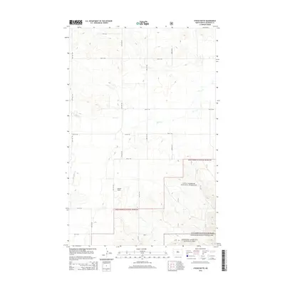
2014 Map of Stocke Butte
USGS Topo · Published 2014About this map
Theodore Roosevelt National Park anchors the southeastern corner of this North Dakota landscape, where the Badlands terrain begins to influence the layout of the region. The map captures a largely open pastoral environment characterized by the expansive Little Missouri National Grassland, which dominates the southern half of the quadrangle. A systematic grid of section-line roads, including 22nd St NW and 134th Ave NW, overlays the topography, though many are forced to follow the natural contours of the rising bluffs and coulees. Water management and drainage are defined by the winding paths of Cherry Cr and Red Wing Cr. Local landmarks like Stocke Butte rise above the surrounding prairie, serving as prominent navigational points for residents and visitors traveling toward the national park boundary via Scenic Dr.
Find a feature on this map
19 named features on this map. Tap any name to fly to it.
Don’t see what you’re looking for? This feature index may not catch every label — zoom into the map to look around manually.
Map Details
Editions of this 2014 Stocke Butte Map
This is the sole edition of this map. No revisions or reprints were ever made.
Other maps of this area

1953 · Watford City
USGS Topo · 1:250,000

1957 · Watford City
USGS Topo · 1:250,000

1958 · Long X Divide
USGS Topo · 1:24,000

1958 · Sperati Point
USGS Topo · 1:24,000

1958 · Stocke Butte
USGS Topo · 1:24,000

1958 · Tepee Buttes
USGS Topo · 1:24,000

1967 · Watford City
USGS Topo · 1:250,000

1972 · Bear Butte
USGS Topo · 1:24,000

1972 · Rawson
USGS Topo · 1:24,000

1978 · Arnegard
USGS Topo · 1:24,000