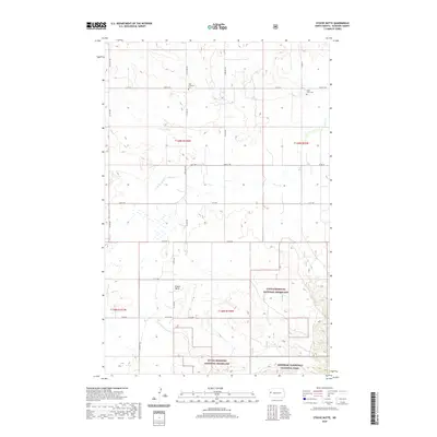
2020 Map of Stocke Butte
USGS Topo · Published 2020About this map
Little Missouri National Grassland and the northern tip of Theodore Roosevelt National Park anchor this corner of McKenzie County. The landscape is defined by the high point of Stocke Butte and the drainage patterns of Cherry Cr, Red Wing Cr, and Wolf. The map reveals a rural structure organized by a strict grid of section lines and local routes such as 136th Ave NW and 22nd St NW. For those researching local family histories, the map identifies specific burial sites including Zoar Lutheran Cem and the Olson Farm Cem, providing precise locations for these small rural landmarks. The arrangement of these cemeteries and the network of section roads like Co Rd 30 reflect the enduring legacy of the Public Land Survey System in this portion of the North Dakota badlands region.
Find a feature on this map
32 named features on this map. Tap any name to fly to it.
Don’t see what you’re looking for? This feature index may not catch every label — zoom into the map to look around manually.
Map Details
Editions of this 2020 Stocke Butte Map
This is the sole edition of this map. No revisions or reprints were ever made.
Other maps of this area

1953 · Watford City
USGS Topo · 1:250,000

1957 · Watford City
USGS Topo · 1:250,000

1958 · Long X Divide
USGS Topo · 1:24,000

1958 · Sperati Point
USGS Topo · 1:24,000

1958 · Stocke Butte
USGS Topo · 1:24,000

1958 · Tepee Buttes
USGS Topo · 1:24,000

1967 · Watford City
USGS Topo · 1:250,000

1972 · Bear Butte
USGS Topo · 1:24,000

1972 · Rawson
USGS Topo · 1:24,000

1978 · Arnegard
USGS Topo · 1:24,000