Loading...
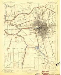
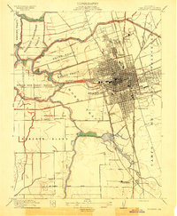
Loading map...1913 Map of Stockton
USGS Topo · Published 1943About this map
Stockton serves as the focal point of this pre-WWI landscape, defined by a dense grid of streets and a complex convergence of rail and water transport. The Stockton Channel reaches into the heart of the city, flanked by extensive tracts of reclaimed land such as the Weber Tract and Smith Tract. To the north, the massive grounds of the State Hospital and the Stockton Rural Cemetery mark the city's expanding footprint.
Find a feature on this map
55 named features on this map. Tap any name to fly to it.
Don’t see what you’re looking for? This feature index may not catch every label — zoom into the map to look around manually.
Map Details
Date Portrayed1913
Date Published1943
PublisherU.S. Geological Survey
Map TypeTopographic
Scale1:31,680
Physical Dimensions16.2 x 19.8 inches
Editions of this 1913 Stockton Map
2 editions found
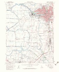
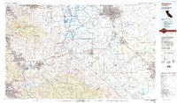
Historical Maps of Stockton Through Time
3 maps found
Featured Locations
Source Details
SourceU.S. Geological Survey
CopyrightPublic Domain