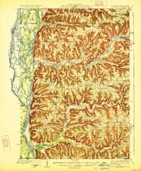
1926 Map of Stoddard
USGS Topo · Published 1926About this map
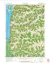
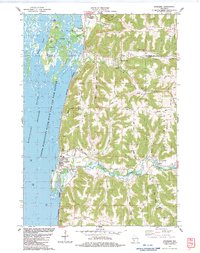
The Mississippi River creates a complex network of sloughs and islands along the western edge of this 1920s landscape, providing a sharp contrast to the deeply dissected ridges to the east. The Chicago Burlington and Quincy Railroad traces the narrow riverbank, connecting riverfront landings like Warner Landing with the village of Stoddard. Inland, the terrain is defined by a dense concentration of rural one-room schools, including the Evening Star School, White Pigeon School, and Hickory Ridge School, which served the farming families scattered across the steep coulees and high ridges.
Find a feature on this map
88 named features on this map. Tap any name to fly to it.
Don’t see what you’re looking for? This feature index may not catch every label — zoom into the map to look around manually.
Map Details
Editions of this 1926 Stoddard Map
2 editions found

Historical Maps of La Crosse Through Time
8 maps found