
1924 Map of Stokes Mountain
USGS Topo · Published 1924About this map
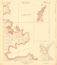
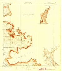
Stokes Mountain and its surrounding foothills dominated the landscape of Tulare County during the early 1920s, as shown in this topographic survey. The map focuses on the complex transition from the rising slopes to the floor of Woodlake Valley, where early 20th-century life centered around landmarks like the Elda School. This particular survey is notably fragmented, illustrating only the higher elevations and drainage basins of Sand Creek and Cottonwood Creek while referencing the earlier Dinuba survey for the lower valley floor. The southwestern corner shows a trace of the A. T. & S. F. railroad, indicating the essential rail connections that linked these mountain foothills to the broader agricultural economy of the Central Valley during this era of California's development.
Find a feature on this map
12 named features on this map. Tap any name to fly to it.
Don’t see what you’re looking for? This feature index may not catch every label — zoom into the map to look around manually.
Map Details
Editions of this 1924 Stokes Mountain Map
3 editions found
Other maps of this area

1921 · Squaw Valley
USGS Topo · 1:31,680

1921 · Stokes Mountain
USGS Topo · 1:24,000

1922 · Trimmer
USGS Topo · 1:96,000

1923 · Sultana
USGS Topo · 1:31,680

1924 · Citrus Cove
USGS Topo · 1:31,680

1924 · Dinuba
USGS Topo · 1:125,000

1926 · Ivanhoe
USGS Topo · 1:31,680

1927 · Monson
USGS Topo · 1:31,680

1928 · Lemon Cove
USGS Topo · 1:31,680

1942 · Dunlap
USGS Topo · 1:62,500