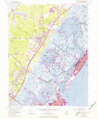
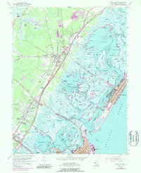
1955 Map of Stone Harbor
USGS Topo · Published 1973About this map
The coastal transition of Cape May County is meticulously documented here, showing the mainland seat of Cape May Court House linked to the barrier island community of Stone Harbor by a vast network of sounds and marshes. The inland settlements of Whitesboro, Burleigh, and Mayville follow the transit corridor defined by Seashore Road and the Pennsylvania Reading Seashore Lines. Local institutions such as the Middle Township High Sch and St Stevens Ch anchor the community, while the Garden State Parkway cuts through the landscape with multiple interchanges including Interchange No 10. The eastern half of the map is dominated by the intricate waterways of Great Sound and Gull Island Thorofare, providing a detailed look at the complex maritime geography of Paddy Bar, Sturgeon Point, and Shellbed Landing before reaching the Atlantic coast.
Find a feature on this map
181 named features on this map. Tap any name to fly to it.
Don’t see what you’re looking for? This feature index may not catch every label — zoom into the map to look around manually.
Map Details
Editions of this 1955 Stone Harbor Map
5 editions found
Other maps of this area

1884 · Sea Isle
USGS Topo · 1:62,500

1888 · Cape May
USGS Topo · 1:62,500

1888 · Dennisville
USGS Topo · 1:62,500

1888 · Sea Isle
USGS Topo · 1:62,500

1893 · Cape May
USGS Topo · 1:62,500

1894 · Dennisville
USGS Topo · 1:62,500

1894 · Sea Isle
USGS Topo · 1:62,500

1898 · Cape May
USGS Topo · 1:62,500

1918 · Cape May
USGS Topo · 1:62,500

1919 · Sea Isle
USGS Topo · 1:62,500