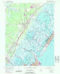
1955 Map of Stone Harbor
USGS Topo · Published 1990About this map
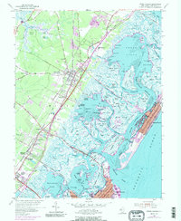
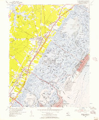
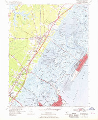
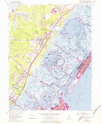
Cape May Court House serves as a focal point in this coastal survey, where the terrestrial landscape of Middle and Lower townships meets the intricate wetlands of the Atlantic coast. The map illustrates a complex network of waterways, including Great Sound, Jenkins Sound, and Grassy Sound, which isolate the barrier island communities of Stone Harbor and North Wildwood from the mainland. The transportation infrastructure of the mid-20th century is clearly defined by the Pennsylvania Reading Seashore Lines and the emerging path of the Garden State Parkway, showing the region's transition into a major seasonal destination. Local landmarks like the Cresthaven (County Home), the Lighthouse near Hereford Inlet, and various landings such as Bennys Landing highlight the mix of civic institutions and maritime dependencies. The survey also captures smaller inland developments like Whitesboro and Marlyn Manor, providing a detailed look at settlement patterns before late-century expansion.
Find a feature on this map
162 named features on this map. Tap any name to fly to it.
Don’t see what you’re looking for? This feature index may not catch every label — zoom into the map to look around manually.
Map Details
Editions of this 1955 Stone Harbor Map
5 editions found
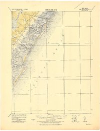
Other maps of this area

1884 · Sea Isle
USGS Topo · 1:62,500

1888 · Cape May
USGS Topo · 1:62,500

1888 · Dennisville
USGS Topo · 1:62,500

1888 · Sea Isle
USGS Topo · 1:62,500

1893 · Cape May
USGS Topo · 1:62,500

1894 · Dennisville
USGS Topo · 1:62,500

1894 · Sea Isle
USGS Topo · 1:62,500

1898 · Cape May
USGS Topo · 1:62,500

1918 · Cape May
USGS Topo · 1:62,500
1919 · Sea Isle
USGS Topo · 1:62,500