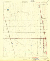
1929 Map of Stone
USGS Topo · Published 1943About this map
Agricultural development and rail expansion define this portion of the San Joaquin Valley surveyed in the late 1920s. The landscape is dominated by the Southern Pacific and the Atchison Topeka and Santa Fe railroads, which facilitated the growth of local shipping points like Stone and Kernell. The settlement of Delano occupies the southeastern corner, showing an early grid of streets alongside the tracks.
Find a feature on this map
7 named features on this map. Tap any name to fly to it.
Don’t see what you’re looking for? This feature index may not catch every label — zoom into the map to look around manually.
Map Details
Editions of this 1929 Stone Map
3 editions found
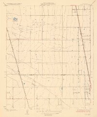
Other maps of this area

1927 · McFarland
USGS Topo · 1:31,680

1929 · Alpaugh
USGS Topo · 1:31,680

1929 · Delano
USGS Topo · 1:31,680

1929 · Sausalito School
USGS Topo · 1:31,680

1929 · Pixley
USGS Topo · 1:31,680

1929 · Stone
USGS Topo · 1:31,680

1929 · Allensworth
USGS Topo · 1:31,680

1930 · McFarland
USGS Topo · 1:31,680

1930 · Hamlin School
USGS Topo · 1:31,680

1930 · Pond
USGS Topo · 1:31,680