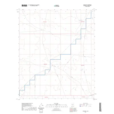
2023 Map of Stone Well
USGS Topo · Published 2023About this map
Fort Bliss military reservation lands dominate the eastern and northern portions of this high-desert landscape in Otero County. The terrain is defined by a network of county roads and desert tracks, including Co Rd F037 and Co Rd F067, which traverse the arid basins between mountain ranges. These routes suggest a history of range management and military access in a region where water sources are scarce and the Public Land Survey System grid provides the primary framework for navigation. The map illustrates the sprawling nature of this borderlands territory, where large-scale land management units like t23s r13e and t22s r12e organize the sparse infrastructure. This 2023 survey serves as a modern record of the durable road networks that connect the isolated wells and ranching sites of the Tularosa Basin area.
Find a feature on this map
16 named features on this map. Tap any name to fly to it.
Don’t see what you’re looking for? This feature index may not catch every label — zoom into the map to look around manually.
Map Details
Editions of this 2023 Stone Well Map
This is the sole edition of this map. No revisions or reprints were ever made.
Other maps of this area

1940 · Bassett Lake
USGS Topo · 1:62,500

1943 · Pendejo Wash
USGS Topo · 1:62,500

1943 · Bassett Lake
USGS Topo · 1:62,500

1954 · Carlsbad
USGS Topo · 1:250,000

1958 · Carlsbad
USGS Topo · 1:250,000

1959 · Alamo Mountain
USGS Topo · 1:62,500

1975 · Alamo Mountain NE
USGS Topo · 1:24,000
1975 · B T Ranch
USGS Topo · 1:24,000
1979 · Otero Mesa South
USGS Topo · 1:24,000

1979 · Crow Flats
USGS Topo · 1:100,000