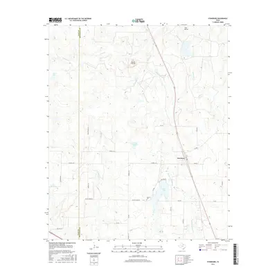
2016 Map of Stoneburg
USGS Topo · Published 2016About this map
Stoneburg sits at the junction of several rural routes along the eastern edge of the Clay County and Montague County line, marking a landscape defined by ranching and water management. This 2016 survey illustrates a terrain of rolling hills and creek drainages, highlighted by prominent topographic landmarks such as Double Mounds and Flag Mound. The drainage patterns of W Belknap Cr, Middle Belknap Cr, and Rattlesnake Cr converge near several artificial impoundments including Bowie Lake and C E Campbell Lake. For local historians and genealogists, the map provides precise locations for family-named roads and the Hopewell Cem, which remains a central point of interest in this sparsely populated cattle country. The proximity of Plaxco Lake and the network of local ranch roads like Butler Ranch Rd and Kennedy Rd suggest a continuing tradition of land use that has shaped this part of North Texas for generations.
Find a feature on this map
32 named features on this map. Tap any name to fly to it.
Don’t see what you’re looking for? This feature index may not catch every label — zoom into the map to look around manually.
Map Details
Editions of this 2016 Stoneburg Map
This is the sole edition of this map. No revisions or reprints were ever made.
Other maps of this area

1905 · Montague
USGS Topo · 1:125,000

1954 · Sherman
USGS Topo · 1:250,000

1954 · Wichita Falls
USGS Topo · 1:250,000

1956 · Henrietta
USGS Topo · 1:62,500

1958 · Wichita Falls
USGS Topo · 1:250,000

1958 · Sherman
USGS Topo · 1:250,000

1960 · Buzzard Roost Knob
USGS Topo · 1:24,000

1961 · Stoneburg
USGS Topo · 1:24,000

1961 · Brushy Mound
USGS Topo · 1:24,000

1961 · Bowie
USGS Topo · 1:24,000