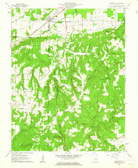
1961 Map of Stonefort
USGS Topo · Published 1962About this map
Stonefort and the adjacent Oldtown occupy a unique position along the New York Central railroad, where the line crosses the boundary of Williamson and Saline counties. The landscape is defined by the complex drainages of the Little Saline River and numerous hollows such as Katy Reid Hollow and Buzzard Roost Hollow. This 1961 field-checked survey reveals a rural landscape deeply rooted in communal life, evidenced by the high density of small country churches and cemeteries. From Walnut Grove Ch in the northwest to Cedar Grove Ch in the southeast, these landmarks reveal the social geography of the era. The terrain transitions into the Shawnee National Forest, featuring landmarks like Stonefort Bluff and the McCormick Lookout Tower, while natural features like Burden Falls and Watkins Ford mark the movement across the various branches of Bay Creek.
Find a feature on this map
56 named features on this map. Tap any name to fly to it.
Don’t see what you’re looking for? This feature index may not catch every label — zoom into the map to look around manually.
Map Details
Editions of this 1961 Stonefort Map
2 editions found
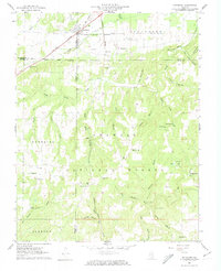
Other maps of this area

1917 · Brownfield
USGS Topo · 1:62,500

1918 · Vienna
USGS Topo · 1:62,500

1919 · Vienna
USGS Topo · 1:62,500

1925 · Marion
USGS Topo · 1:62,500

1925 · Harrisburg
USGS Topo · 1:62,500

1939 · Harrisburg
USGS Topo · 1:62,500

1940 · Marion
USGS Topo · 1:62,500

1942 · Vienna
USGS Topo · 1:62,500

1949 · Paducah
USGS Topo · 1:250,000

1950 · Paducah
USGS Topo · 1:250,000