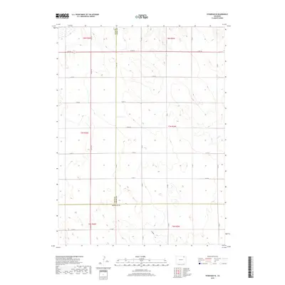
2019 Map of Stoneham SE
USGS Topo · Published 2019About this map
The high plains of Colorado intersect at the tri-county corner of Weld, Logan, and Morgan counties in this 2019 survey. The landscape is characterized by a sparse, grid-like road network and subtle drainage patterns such as Sand Cr in the east and the L F Draw in the south. This area represents a classic section of the Great Plains, where the survey lines of t8n r55w and its neighboring townships define the agricultural and ranching boundaries. Unlike more developed regions, the human footprint here is primarily expressed through long-stretching county routes, including Co Rd 155 and Co Rd 26, which facilitate movement across this expansive terrain. The map provides a look at modern land division where the three counties converge at a single point, a feature of significant interest for local boundary history and geography.
Find a feature on this map
32 named features on this map. Tap any name to fly to it.
Don’t see what you’re looking for? This feature index may not catch every label — zoom into the map to look around manually.
Map Details
Editions of this 2019 Stoneham SE Map
This is the sole edition of this map. No revisions or reprints were ever made.
Other maps of this area

1951 · Dead Horse Springs
USGS Topo · 1:24,000

1951 · Willard
USGS Topo · 1:24,000

1951 · Messex
USGS Topo · 1:24,000

1951 · Antelope Springs
USGS Topo · 1:24,000

1951 · Wild Horse Lake
USGS Topo · 1:24,000

1954 · Sterling
USGS Topo · 1:250,000

1958 · Sterling
USGS Topo · 1:250,000

1971 · Messex
USGS Topo · 1:24,000

1977 · Stoneham
USGS Topo · 1:24,000

1977 · Stoneham NE
USGS Topo · 1:24,000